
Precision Aerial Services for Philadelphia & Pennsylvania
Elevating Your Pennsylvania Perspective
Philadelphia Helicopter Charters provides unparalleled versatility for comprehensive aerial surveys across Pennsylvania, utilizing the distinct advantages of helicopter flight. Our capabilities encompass advanced services such as magnetometer and electromagnetic surveys, LiDAR mapping, and precision GIS data acquisition. The helicopter's unique low-altitude and stable hover characteristics enable superior data collection critical for infrastructure assessment, resource management, and environmental monitoring projects. Furthermore, we specialize in high-definition aerial filming and photography, offering state-of-the-art camera systems and customizable aircraft configurations, including door-off operations for optimal handheld capture. We are dedicated to equipping your projects with precise visual and geospatial intelligence, ensuring exceptional results from above the expansive landscapes of Pennsylvania.
Aerial
Surveys
LiDAR, GIS Maps, FLIR, HD Video & More
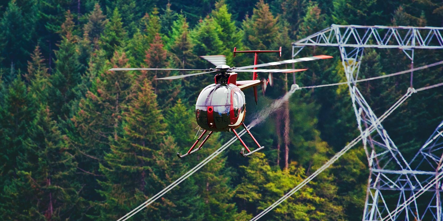
Philadelphia Helicopter Charters delivers precise aerial support for critical infrastructure management across the region. Our specialized solutions encompass comprehensive pipeline integrity surveys, detailed Right-of-Way (ROW) inspections, and proactive transmission line patrols. We ensure your project's success by providing access to meticulously equipped aircraft, precisely configured for reliable and accurate data acquisition.
High Tech Results
The Top Pilots in Pennsylvania, Today's Technology... Maximum Results.
Call 1-866-826-4826 Now!
Philadelphia Helicopter Charters provides the tools needed to complete your land surveys, utilizing the right equipment to provide the aerial photos that are often needed.
Optimized aerial surveys are indispensable for simplifying Right-of-Way (ROW) and comprehensive site inspections, precise topographical data acquisition, and high-definition photographic documentation vital for commercial ventures across Pennsylvania. Helicopter-based surveys provide an unparalleled vantage point for meticulous examination of the varied Pennsylvania terrain, enabling rapid identification of pipeline anomalies, critical assessment of transmission line integrity, and detailed visual documentation of properties. Philadelphia Helicopter Charters specializes in developing bespoke photographic and remote sensing operations, custom-engineered to maximize both technical efficacy and financial efficiency, thereby ensuring superior results for your critical infrastructure and land management projects.
Helicopters offer distinct operational advantages for detailed aerial surveying, primarily due to their superior maneuverability at lower altitudes and slower airspeeds compared to fixed-wing aircraft. While fixed-wing operations are typically restricted by FAA regulations to altitudes of 1,000 feet above obstacles, helicopters possess the unique capability to conduct surveys at significantly reduced heights. This precision enables close-range inspection of critical infrastructure and environmental features, providing engineers and technical teams with an otherwise unattainable, granular perspective on challenging or hazardous zones throughout Pennsylvania. This capability enhances data accuracy and operational safety.
There is no better way to conduct your visual survey, animal population counts, soil drainage analysis, ROW inspections, pipeline and transmission line inspections, and geographical surveys.

LiDAR Imaging
Light Detection and Ranging, or LiDAR, is a remote sensing method used to examine and measure Pennsylvania topography as well as objects, like vegetation, upon it.

Infrared Imaging
Thermographic IR cameras are used to detect radiation in the long-infrared range of the electromagnetic spectrum and produce images of that radiation, called thermograms.

HD Video Gimbal Capture
Modern HD and 4K cameras can be mounted to helicopters, using the proper STCs, with a gimbal to stabilize photos & videos for detailed results.
Specialized Aerial Cinematography and Media Production
For expert camera work in the Philadelphia Sky
Get a Fast, free QuotePhiladelphia Aerial Cinematography
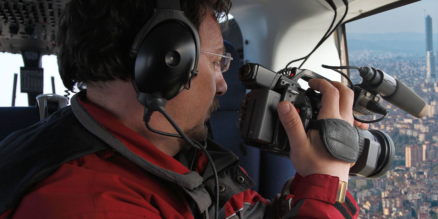
Philadelphia Helicopter Charters provides unparalleled access to professional-grade aerial cinematography resources throughout Pennsylvania, enabling your production to achieve stunning visual narratives. We facilitate custom shoots utilizing the industry's most advanced gyro-stabilized camera mounts, including Tyler Mounts, Wesscam, Cineflex, Pictorvision, and SpaceCam, paired with cutting-edge specialty cameras such as Cineflex HD, RED Epic, and Arri Alexa, alongside advanced 3D and experimental camera systems. This comprehensive suite supports all aspects of your production goals, from dynamic air-to-air sequences to intricate ground-to-air shots. We collaborate seamlessly with aerial Directors of Photography and production directors to translate their creative vision into compelling cinematic results. Specializing in helicopter services for both still and motion photography, Philadelphia Helicopter Charters is equipped to support a wide array of media operations across Pennsylvania. This includes feature films, television productions, documentaries, impactful promotional videos, high-definition commercials, aerial prop placements, and essential coverage for major networks encompassing historical events, news, and prominent sporting spectacles, all delivered with precision and technical excellence.
Call Us Today at 1-866-826-4826 for a Free Quote
Contact Us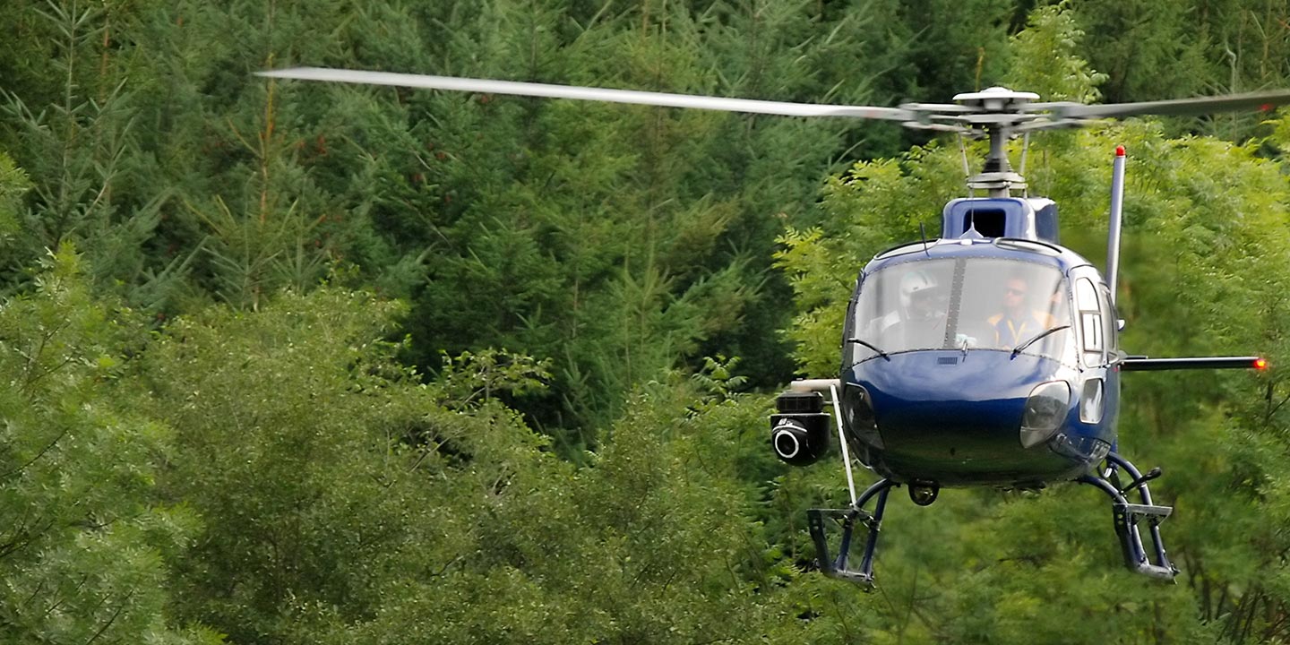
Aerial Photos
Hand-held or Mounted OpTions in Philadelphia
We will help you get the right equipment for your aerial photography project! Call 1-866-826-4826 today to get a fast, free quote.
The Most Options for Photography
For capturing the spectacular settings and breathtaking views across Pennsylvania, an aerial perspective offers an unmatched advantage. Philadelphia Helicopter Charters specializes in designing bespoke aerial photography charters, meticulously crafted to transform your artistic vision into captivating imagery. We provide cost-effective photographic opportunities tailored for diverse projects, from commercial campaigns showcasing Philadelphia's urban sprawl or the serene landscapes of the Pocono Mountains, to intricate infrastructure documentation. Aircraft can be configured for optimal capture, including options for door-off operations to facilitate handheld photography. For superior stability and cinematic precision, advanced gyro-stabilized camera mounts are available, ensuring professional-grade results that consistently exceed expectations.
Superior Service
Every one of our customers gets a dedicated helicopter expert to assist with flight plans, tech loadouts, production logistics, project schedules, and other demands.
Over 500 Aircraft
Our network of direct air partners extends well beyond Philadelphia, Pennsylvania. This allows us to offer a wide range of solutions for even the most sophisticated projects.
The Best Equipment
From high-tech sensors like LiDAR, FLIR, and GIS to HD cameras and movie production gimbals, we're here to make your job as easy as possible.


